


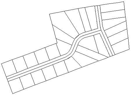
Another situation that you may encounter is that you receive maps, plans, or other data that has been created by contractors, but which does not have any geoferencing information at all. For example, a map of a new subdivision that has been drafted in AutoCAD will not contain any georeferencing. You may know where the subdivision has to go in your map, but the DWG that you have received consists of a set of simple polylines, or other DWG objects without any coordinate system.
In a case like this, you can place the subdivision in your map using a process called rubbersheeting. What the Rubber Sheet command does is to move, rotate, and scale the selected DWG objects as required to fit them into the map. You select a series of points in pairs—first a start, or source, point, then a destination, or displacement, point. The process is very similar to the standard Move command in AutoCAD, only you use more than one pair of points. The more pairs you enter, the more accurate and precise the result.
The illustration below shows how you might use four pairs of points to fit the subdivision into the target location. If you have ever tried using simple Move and Scale commands to fit DWG objects precisely, you will find that the Rubber Sheet command in AutoCAD Map 3D is much easier to use and is more accurate.
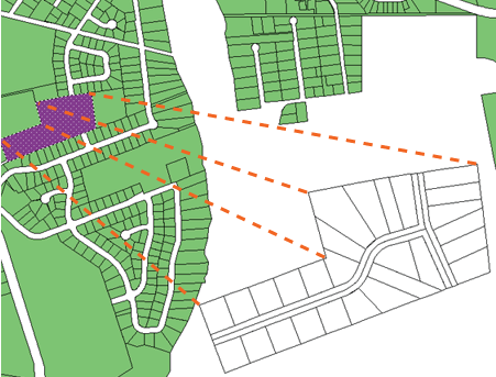
For the sake of speed and simplicity, this demonstration uses only two pairs of points to rubbersheet the subdivision. However, when you use this command, you would want to use at least four pairs to get a good result. You would also want to use OSNAP judiciously to make sure that you snap to the right points.
In this animation, the set of parcels has been defined as a block so that it can be copied and pasted as a single object.