


What happens when you want to use an image that does not have any georeferencing information? You do not know the coordinates of the image relative to the coordinate system of the map, so the image will not be aligned with the data that you already have in your map.
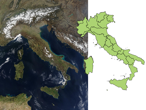
This is not an ideal situation. However, you can still use the image, especially if you only need to use it as a background and as long as you do not need to have it align extremely precisely with existing features. For example, the illustration below shows a map of Italy. This is a small-scale map, in which the coastline and boundaries of the regions have been generalized. They are not precise and so, in this case, we can use the image on the left as a background for the map and it will be close enough.
This example assumes that you have assigned an appropriate coordinate system to your map and that you already have at least one layer of features that you can align the image to.
In this case, you can use the Insert Image command (instead of the Raster Provider in Data Connect). You use this command to bring the image into the map so that it is more or less in the correct position, and at roughly the correct size. A simple way to do this is to draw a rectangle on the map as a guide. You then insert the image, snapping the image to the corners of the rectangle.
Show me how to insert an image using a guide
Once you have the image in the map, you can use the ADETRANSFORM command to align it with the features in the map. This command moves, rotates, and scales the image all at the same time. You pick two source points and two destination points to specify how the image should be transformed. You may get it right first time, but more likely you will need to repeat the command to get a satisfactory result.