


Map books are sets of plans that show infrastructure and property details, for example, for a municipality or utility company. Each page in a map book shows a tiled area linked to a key map that shows the position of each tile in the larger framework. Map books are often used by mobile work crews in the field. The convenience of having a book of easy-to-manage sheets that covers the entire work area helps crews to complete their work orders in a timely fashion. This system works best when the map book can be automatically refreshed on a regular basis from the most up-to-date data.
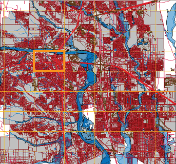
The important factors in creating a really useful map book are choosing the right scale and careful preparation of a layout sheet. You need to divide your coverage area into tiles that are the right size for the pages of a map book. The city map shown below has been divided into tiles which are useful as areas for querying and editing source data, but which are too big to serve as map book tiles.
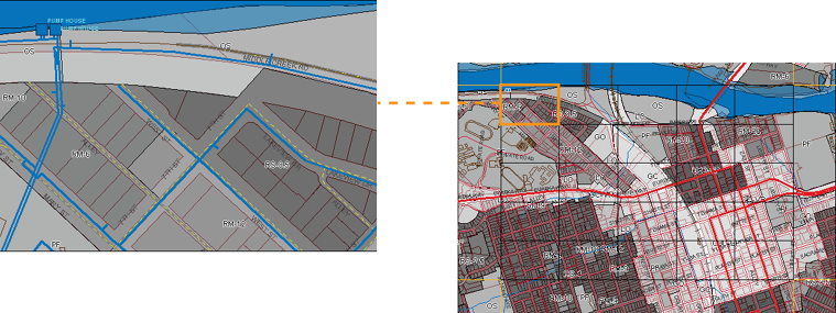
However, you can use one of the larger tiles as a starting point for the Map Book tool in AutoCAD Map 3D. You can then subdivide the larger area (shown on the right in the illustration below) into smaller tiles (like the one on the left).
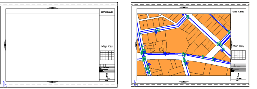
You can save time by creating a template (.dwt) file and a sheet set (.dst) file to define the pages of your map book. The template defines borders and title blocks, plus navigation aids such as a key map and the arrows which point to adjacent sheets. The sheet set specifies the content of each numbered tile. The illustration below shows a blank template (on the left) and the same template when it has a tile of data assigned to it by the sheet set.
Once you create a Map Book, you can publish it to a plotter or to an Autodesk DWF file. If you publish to a DWF file, the map book willl be interactive, for example, you can click the adjacent arrows to go from one page to another. See Produce a multi-sheet DWF file for a map book.
The following animation condenses the process of creating a map book by using a pre-defined file for the map book settings. This fills in some of the values in advance, such as the numbering scheme for the tiles. We also use a pre-defined sheet template to set up the map book pages for publishing. The map book created in this example is not large—it only covers one of the large tiles in the first illustration on this page. However, the steps are the same for a map book of any size.