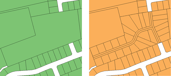
Splitting polygons that represent parcels is a very common task, but it can become a fairly complex one, due to the number of people who may be involved and the use of different software programs.

It is common practice to store parcel data as features in a central database while new subdivisions are created in a DWG file, using AutoCAD, AutoCAD Map 3D, or AutoCAD Civil 3D. What is the best way to handle this kind of workflow?
Ideally, you want to minimize the number of times that the data changes format and also minimize the total number of steps that need to be performed. Here is one solution:
- Save the parcel or parcels to be subdivided as a DWG file using AutoCAD Map 3D.
- Do the subdivision work in AutoCAD Civil 3D, to take advantage of its ability to automate parcel-creation and attribute assignment.
- Export the subdivided parcels to SDF format.
- Import the subdivided parcels back into AutoCAD Map 3D.
- Update the parcels database.
This method uses only two formats: SDF and DWG,
and only two programs: AutoCAD Map 3D and AutoCAD Civil 3D. (This
is assuming that you have your parcel fabric stored in an SDF database.
However, the process would be the same if the parcels were in Oracle
or any other supported data store.) If you store your parcel data
in DWG files, the effort involved to convert them to SDF is relatively
trivial, using Export from DWG to SDF (see
The first step is to extract the parcel or parcels that you need to edit from the database, convert it to simple geometric objects, and save the objects as a DWG file. You can then give the DWG to the engineer who will create the subdivision design.
Show me how to convert a parcel to simple geometry
When the design is complete, the engineer saves the parcels for the subdivision as an SDF file. The SDF file may also contain other features such as pipes and road alignments. You can easily bring this data into AutoCAD Map 3D with a standard Data Connect operation. Because the data has retained its georeferencing information throughout the process, you can be sure that it will come in at exactly the right location.
Show me how to bring in data from AutoCAD Civil 3D


