


A buffer zone is a polygon that is drawn at a specific distance around a selected feature. It is typically used as a way to select features in the map for further analysis. For example, you may want to select parcels within a certain radius of a construction site. Once you have identified the parcels that you want, you can copy them to a separate layer, export the list of records to a speadsheet, and so on (see Generate a report by exporting records to a spreadsheet).
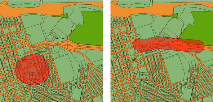
You can create buffers around polygons, points, or lines. In the Buffer Features dialog box, you specify the distance for the buffer zone. The distance becomes the radius of a circle if the selected feature is a point. If it is a polygon or a line, as in the examples shown below, the buffer zone will be irregular in shape. Buffers can overlap (you will learn more about the uses of overlapping buffers in the next skill).
The buffer zone is created as a polygon on its own layer. By default, it is styled to be semi-transparent. The polygon is also saved as a separate SDF file. When you want to select the parcels inside (or touched by) the buffer zone, all you need to do is make a location query, with the location defined by the buffer polygon (see the Examples section of this skill and the next skill for animated demonstrations of how to do this).
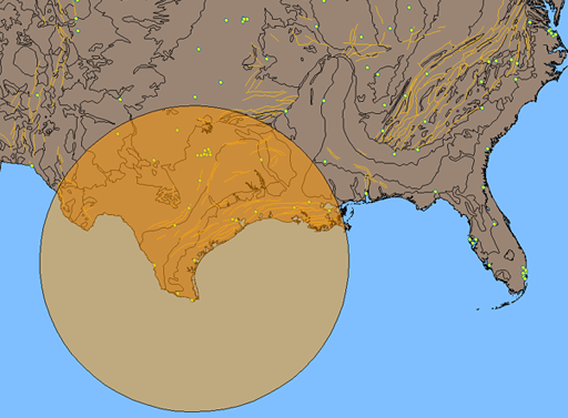
This illustration shows the result of a buffer operation around a city point, using a distance of 500 miles.
The first animation shows a simple, but common, case, in which we create a buffer around a parcel at a distance of 200 meters. Because this is a single parcel polygon, there is no overlapping or merging.
Show me how to create a buffer zone around a parcel
Beginning with the buffer zone created in the first animation, we use it as the basis of a location query. The goal is to identify only those parcels crossed by the buffer zone. The result is a set of parcel records, which we can view and manipulate in the Data Table.