


One of the most exciting aspects of the increase in computer processing power in the last ten years or so is the ability to create and view accurate 3D terrain models. Today, you can interact with 3D surfaces almost as easily as you can with a 2D map. As well as being a lot of fun to navigate, 3D models can show you aspects of a site or landscape that you can’t visualize from an ordinary map. However well you can read contours or other cartographic conventions, there is no substitute for being able to see the relative heights and positions of landmarks in three dimensions. This is especially useful for the site analysis phases of engineering projects.
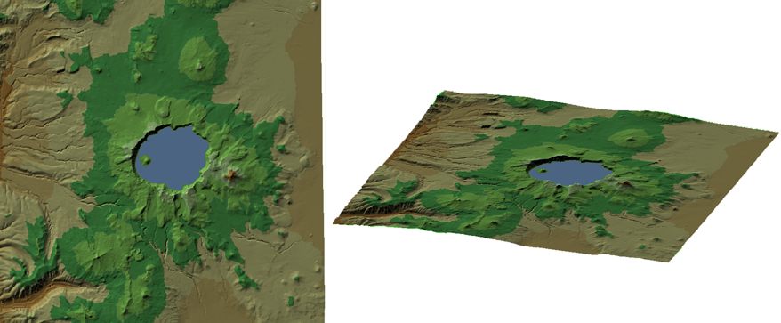
The illustration below shows a model of Crater Lake, in the state of Oregon, USA, rendered from two surfaces in ArcGrid format.
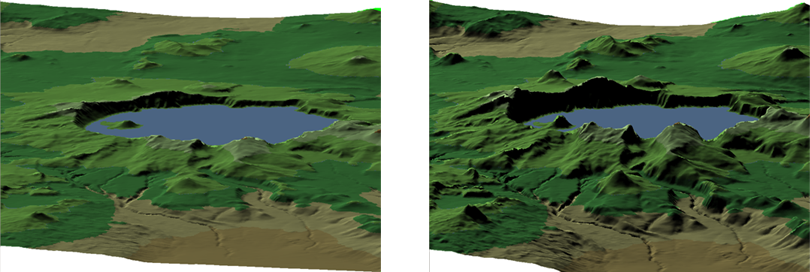
It can be useful to enhance your view of a surface by exaggerating the vertical dimension, especially for terrain that is mostly flat, or which varies only slightly in elevation. The following illustration shows a view of Crater Lake with the normal horizontal-vertical ratio on the left. The view on the right exaggerates the vertical dimension to 2, that is, a vertical distance is equal to twice the horizontal distance. This exaggeration emphasises the differences between elevation values and gives a more dramatic effect.
When you switch to 3D mode in AutoCAD Map 3D, a new 3D toolbar becomes available. You can use these tools to change your viewpoint, move in and out, rotate the surface, and so on.
Show me how to view and navigate in 3D
The second animation shows how to move your viewpoint close to the surface to obtain a view like the one in the second illustration above. It also demonstrates how to adjust the setting for vertical exaggeration.
Show me how to exaggerate the vertical dimension of a surface