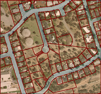
Using aerial photographs or satellite photographs as a background is a good way to provide a context for your map. For example, if you are drafting new services such as pipes or cables, a photograph will show you where the buildings are located, as well as the location of potential obstacles such as trees. If you add a parcel layer on top of the photograph, you get an excellent picture of the existing conditions.
It is especially useful to be able to make the parcels layer partially transparent, so that you can see both the parcel boundaries and the photo background, as in the illustration below.

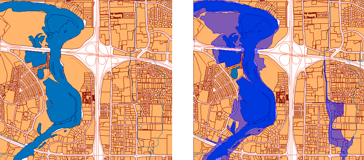
Another useful application of transparency is to create a overlay of one feature layer on top of another, for example, to show the parcels that fall within a flood zone.
In the illustration below, the river is shown without its flood zone on the left and with the flood zone on the right. The layer showing the extent of the flooded area has been made partially transparent to show which parcels are affected.

The following animation uses the flood zone as an example. The floodzone layer overlays the river layer but it is opaque (which is the default for all polygon layers). In this demonstration, we change the style to make the fill color 50% transparent. This gives the effect shown in the illustration.
Show me how to make the features on a layer semi-transparent


