Edit features as polylines using PEDIT
From GIS Skills
When you are editing polylines, you use various AutoCAD tools, such as TRIM, BREAK, and of course, PEDIT. If your map includes features such as pipes or roads, which are represented by polylines, you can use the same tools to edit them. If you use the default editing options, you can edit DWG objects and GIS features seamlessly. (These options are described in Edit feature geometry directly in a SHP file using CAD tools.)
Basically, there are two ways to edit features in AutoCAD Map 3D:
- Treat all line and polygon features as though they were simple lines and edit them with AutoCAD tools.
- Treat polygon features as polygons and edit them using geospatial tools.
It is recommended to use the first option and edit using AutoCAD tools unless your organization is accustomed to using geospatial tools to edit areas such as parcels. Geospatial tools take into account the specific properties of polygons. This allows these tools to split and merge polygons and automatically calculate the new areas. For an example of this automatic calculation, see Split a parcel in two and divide attributes.
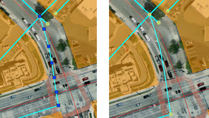
The illustration below shows a network of water pipes. The image on the left shows what happens when you select one of the pipe features. It is immediately available for editing. This is because the default option is selected (Automatically Check Out Features When Edited).
The image on the right shows what happens when this option is not selected. In this case, you have to check out the feature with the Check Out Features command before you can edit it.