


The first phase of many GIS projects is data acquisition. In this phase, you collect the data that you need for your project from various sources. For example, you may need to begin with a parcel map from a central database or a set of files containing infrastructure such as pipes or roads. Sometimes, you may need to browse for data that has been posted by government departments on the Internet. When you acquire data from different sources and share data between different departments, it becomes important to have good descriptions of that data. In the GIS context, information that describes geospatial data sets is called metadata.
Metadata is usually stored in a separate "read-me" text file or xml file that accompanies the data source. Often you will want to look at the metadata to see whether that data is appropriate for your purposes or not. Metadata is divided into several categories. A metadata file will typically contain some or all of the following:
- A brief description of the data set (called an abstract)
- The area covered by the data set
- The data structure and file format
- The coordinate system or projection of the data
- The time that the data was collected and method of collection
- The quality or accuracy of the data
Metadata, when it is complete and up-to-date, can be extremely useful. If you receive a dataset from a colleague or from a local government department, look for a metadata file that describes the data. If there is none, ask your contact person to provide some basic information. You should at least find out what coordinate system the data is in, because you will need to know what it is if you need to reproject the data to bring it into an existing map (see Reproject incoming data to a new coordinate system).
If you are downloading publicly-available data from a government agency, a link to the metadata is usually available from the download page.
There is no single worldwide standard for metadata. However, different government agencies are at work implementing standards within their particular geographical areas. For example, the Federal government in the United States requires the GIS data used in its various departments to comply with the FGDC standard (FGDC stands for Federal Geographic Data Committtee). In other countries, the ISO 19139 metadata standard has been widely adopted.
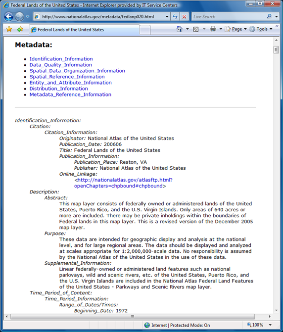
The illustration below shows FGDC-compliant metadata as it appears on a web page.
In AutoCAD Map 3D, you can view metadata for any data source that complies with the FGDC or ISO 19139 standard. You do not have to add the data to your map to view the metadata. You only need to connect to the data source. You can then open the Metadata Viewer from the Map Explorer or Display Manager. The illustration below shows the same metadata as in the previous illustration, as it appears in the Metadata Viewer in AutoCAD Map 3D. (The data to which it refers has been brought into the map and can be seen in the background.)

The following animation shows how to view the metadata for a data source that is connected to the current map. The data in this example comes from a U.S. government source and is therefore in FGDC format. Very often, one of the first things you want to know is the coordinatate system of the data, so the animation demonstrates how to find that information.