Find which lines are within a particular polygon (overlay analysis)
From GIS Skills
Suppose you want to find which railway lines are inside a state boundary or which pipes fall within a certain tax district. You can get the answer you want with an overlay analysis, which involves two topologies: the source topology, for example, the rail network, and the overlay topology, for example, the state boundary polygon. The result of this analysis is similar to what you would get if you used an AutoCAD command to trim the railway lines at the state boundary. This kind of trim or “clip” is one of the most common types of analysis that you can do by overlaying topologies, but it is by no means the only one. Another example would be to find the parcels that fall within a flood zone (called an “intersect”). A third example would be to find all the hydrants in a particular service district that are also within a specific residential zone (“union”).
The illustration below shows the result of an overlay analysis in which the railway lines inside the state of Gujarat, India, are identified. The railway lines are saved to a new topology, which can then be used for further analysis.
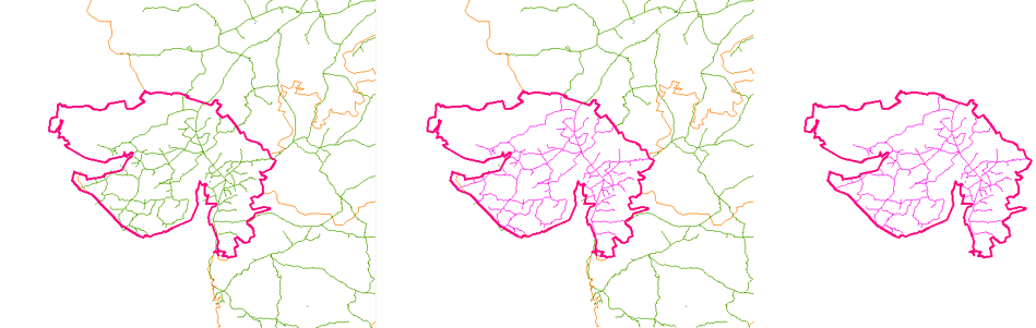
The following demonstration starts with two topologies already loaded: “Indian_railways,” which is the source topology, and “State_of_Gujarat,” which is the overlay topology. The result of the analysis is a new topology, “Gujarat_railways,” which contains only those railway lines that are inside the state boundary.