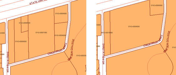
It is often necessary to divide a feature into two or more parts. One of the most common examples is subdividing a parcel. How do you do this if your parcel map is stored as feature data in a database?
If you are receiving the data for the subdivided parcel from an engineer who is using AutoCAD Civil 3D, you can ask him or her to save the parcel data in SDF format. You can then easily bring that data into AutoCAD Map 3D (see Bring in parcel data from AutoCAD Civil 3D).
When you have the parcel map in AutoCAD Map 3D, you can use the Split command to divide a parcel into two or more smaller parcels, as shown in the following illustration.
What happens to the attribute data associated with the parcel when you split it? The attributes are divided according to the “rules” which are set in advance for each property of the parcels layer. For example, a common rule is to reset the AREA properties of the new parcels in a simple proportion. If you split a parcel with an area of 1000 square meters exactly in half, each new parcel will be 500 square meters in area. You could use a similar rule for the LAND_VALUE property, or you may want to leave it blank, pending assessment. Defining these rules is usually the responsibility of the data manager in an organization. Once they have been set up, they are applied automatically, so you don’t have to think about them every time you split a parcel.
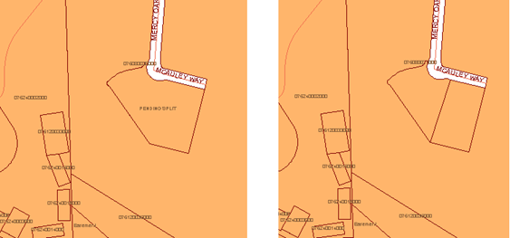
You can also use the Merge command to combine two or more features, as shown below.