


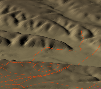
An important part of site analysis is to consider the slope and aspect of the different areas of the terrain. Suppose you are working on a development of the area along the road that winds into the hills in the view below.
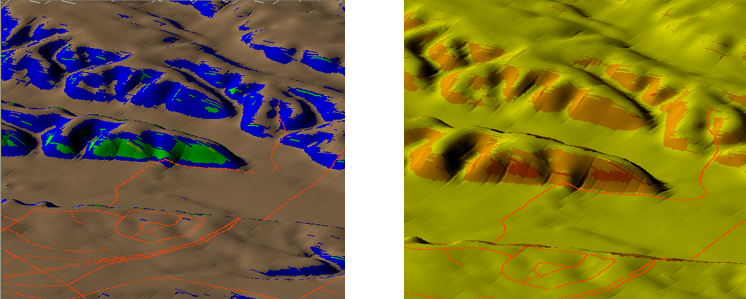
One of the first things you might like to identify are the areas that are too steep to build on. In other words, perform a slope analysis. You have already seen how you can theme the surface to show its elevation (see Color a surface by elevation and adjust hillshading). You can theme the surface to show the slopes of the various landforms in just the same way. Of course, you can also adjust the ranges for the theme and make other changes to get the result that you want (using the techniques demonstrated in Change the elevation ranges for a surface).
The view on the left below shows a slope analysis using the default ranges and the pre-defined Slope palette. The view on the right shows a slope analysis using four rules, distributed equally, and a color ramp from yellow to red. The same slopes have been identified as steep in both analyses, but the colors and ranges are different.
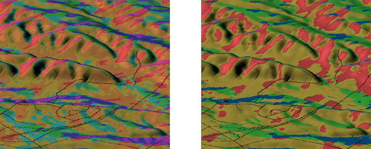
It can also be very useful to visualize the aspect of the different areas of the site. Aspect means the direction in which the land is facing: north, south, east, or west. The purpose of the analysis is usually to find out how much sun hits your site. Is part of the site on a hill facing north or south? Which areas receive full sun all day and which are shady part of the day? When during the day, morning or afternoon, does your site have sun? These are the kind of questions that you can answer with an aspect analysis.
The illustration below shows two aspect analyses of the same site. The view on the left uses the default ranges and the pre-defined Circular Palette for Aspect. This palette divides the 360 degree circle into 16 colors (of 22.5 degrees each). The view on the right removes most of the ranges and simplifies the analysis into four quadrants of 90 degrees each.
This demonstration shows how to analyze a surface using the Slope palette. There are five ranges in the Slope palette. For example, the first range is 0 to 18 and the second range is 18 to 36. (Slope is defined here as a range of numbers that represent the angle of slope rather than as a percentage of slope or a grade ratio.)