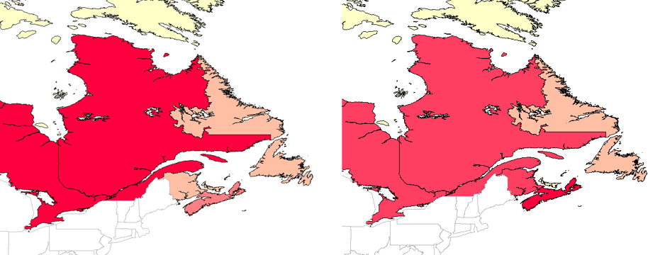
Another way to extend the number of properties available to you is to create a calculated field. Like joins, calculated fields result in extra columns in the data table. You can then use the new property to theme the data. A common example is the addition of a property for population density. This is a simple calculation, which you can do if you have data for population and for area. You simply divide area by population to get the population density.
The picture below shows provinces in Canada themed by population (on the left) and population density (on the right). The provinces of Ontario and Quebec, which appear in red in the population map, are in fact less densely populated than the province of Nova Scotia, which appears in red in the population-density map. This example shows how you can extract additional information from the data that you already have by adding calculated fields.