Lesson 2: Style Map Features

Lesson 2: Style Map Features

Exercise 2: Define the theme

Exercise 1: Create a theme for the parcels layer
A theme uses a range of colors to represent an analogous range of values. You can also use theming to show relative area, population density, water depth, or height of geographic features.
NoteThis exercise uses the BuildMap1.dwg map you created and
modified in the previous exercises.
To style the parcels layer with a theme
- Open
your finished map from the previous lesson.
- Click File menu
 Open.
Open. - Locate BuildMap1.dwg.
- Select it, and click Open.
- Click File menu
- Create
a theme for the parcel layer.
A theme is a display style. Styles for geospatial features are assigned by layer.
- In Display Manager,
select the Parcels layer and click Style. NoteIf the Style Editor is docked, move your cursor over it to display it. It may be docked at the left side of the application window.
- In
the Style Editor, under Polygon Style For 0
- Infinity Scale Range, click New Theme.
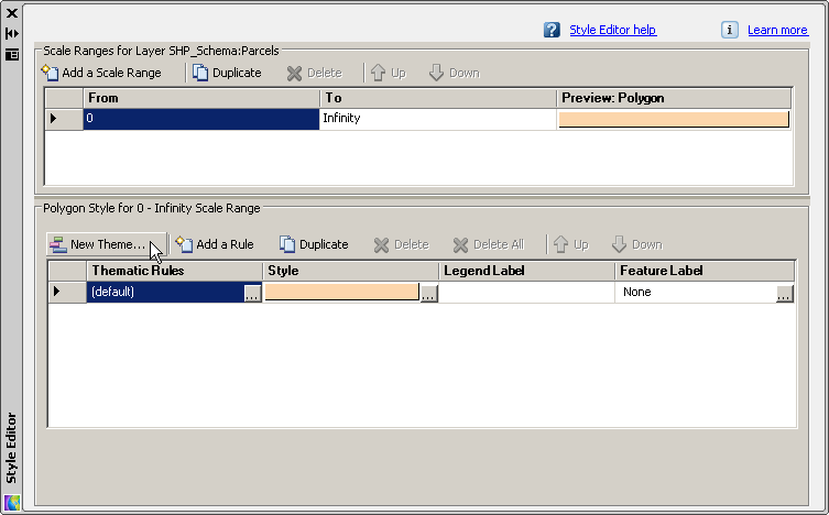
Click New Theme to define a theme for the Parcels layer.
- In Display Manager,
select the Parcels layer and click Style.
To continue this tutorial, go to Exercise 2: Define the theme.