MapCruncher for Microsoft Virtual Earth Help
From MapCruncher
Troubleshooting MapCruncher
Why does my map look so skewed?
One likely possibility is that the map is schematic (not to-scale), like the Washington DC subway map in Figure 1. In that case, MapCruncher cannot transform the map.
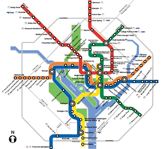
Figure 1. Washington DC Subway Map
Another possibility is that the map is mostly to-scale, but the cartographer has taken a few liberties. MapCruncher had difficulty registering points on the Vashon Island map shown in Figure 2. The note next to the explains why.
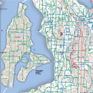
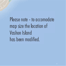
Figure 2. Vashon Island map and note
Another notorious map with liberal geographic features is the New York MTA Subway map. The remark in the key, as shown in Figure 3, explains why.
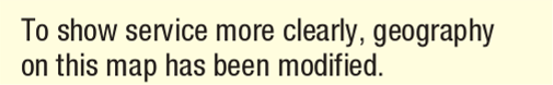
Figure 3. MTA map remark
Another possibility is that you have selected some dramatically incorrect correspondences.
No matter how many points I add, I always have to fine-tune a little
If you have to fine-tune a lot, you may have a not-to-scale map. Perhaps one or two points are incorrectly matched, and are throwing the rest of the approximation off. Use the error column, and re-check the correspondences with the worst errors. Replace suspect correspondences.
Make sure you are using correspondence points that are widely separated on the source map. If you start with a dense cluster, MapCruncher has to extrapolate for far-away points, and extrapolation produces bigger errors than interpolation. In this Los Angeles Transit map, all of the correspondences are in the city, which leaves features at the edge of the map not tied down, as shown in Figure 4.
![]()
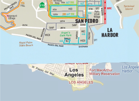
Figure 4. Los Angeles Transit map
Sometimes the road atlas data in Virtual Earth doesn’t match the aerial photography. We recommend registering to features in the Hybrid View, as shown in Figure 5.
Figure 5. Hybrid view
Ultimately, you may never get a perfect match. This can happen due to limitations of MapCruncher’s approximate transformation, or due to errors in the source map itself, as shown in Figure 6.
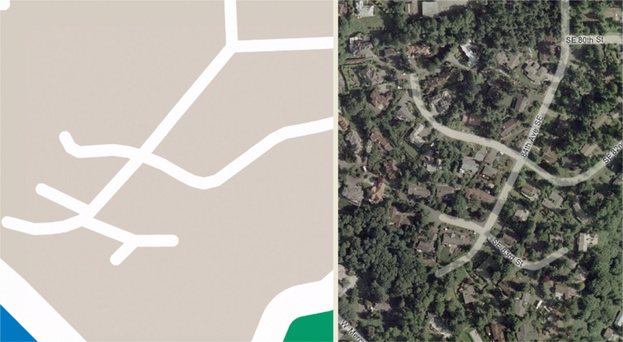
Figure 6. Source map with errors
How many correspondence points do I need?
Some source maps, such as aerial photographs or floor plans, are drawn in “conformal projections”, and can be registered with as few as two points, as shown in Figure 7.
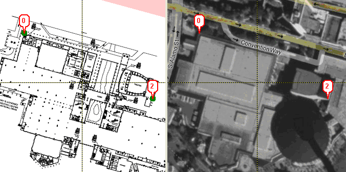
Figure 7. A map with two correspondence points
Other maps require at least three points. Figure 8 shows the two correspondences are correct, but the source map is obviously locked in an incorrect position: the Northern border of Washington is not East-West, as it appears on the right. That’s because the chosen source map happens to not be a conformal projection.
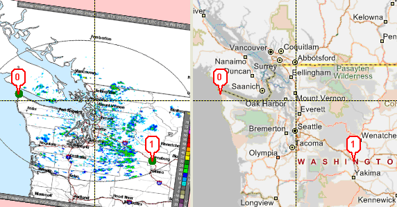
Figure 8. Non-Conformal Projection of Northern Washington
Adding one additional point tells MapCruncher how to fix the problem, as shown in Figure 9.
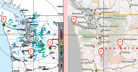
Figure 9. Normal Projection of Northern Washington
MapCruncher rarely needs more than 15 to 20 correspondences, even on detailed maps such as a county-wide map with street-level detail. Beyond that, other sources of error usually limit the fidelity of the results.
| © 2007 Microsoft Corporation. All rights Reserved. | Send Documentation Feedback |